The map can display labels, such as country names. Set the label type and appearance on the "Labels" tab:
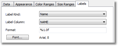
If the "ESRI shapefile" layer type is chosen set the field name which contains the displayed information. In most cases it's a "NAME" field. The world map included in the FastReport demo program contains the following fields:
- NAME (eg: Germany)
- ABBREV (eg: Ger.)
- ISO_A2 (eg: DE)
- ISO_A3 (eg: DEU)
Other maps will have a different set of fields.
If the “application geodata” layer type is chosen set the minimum zoom value for displaying the labels. The default value is 1, meaning the labels are always displayed.